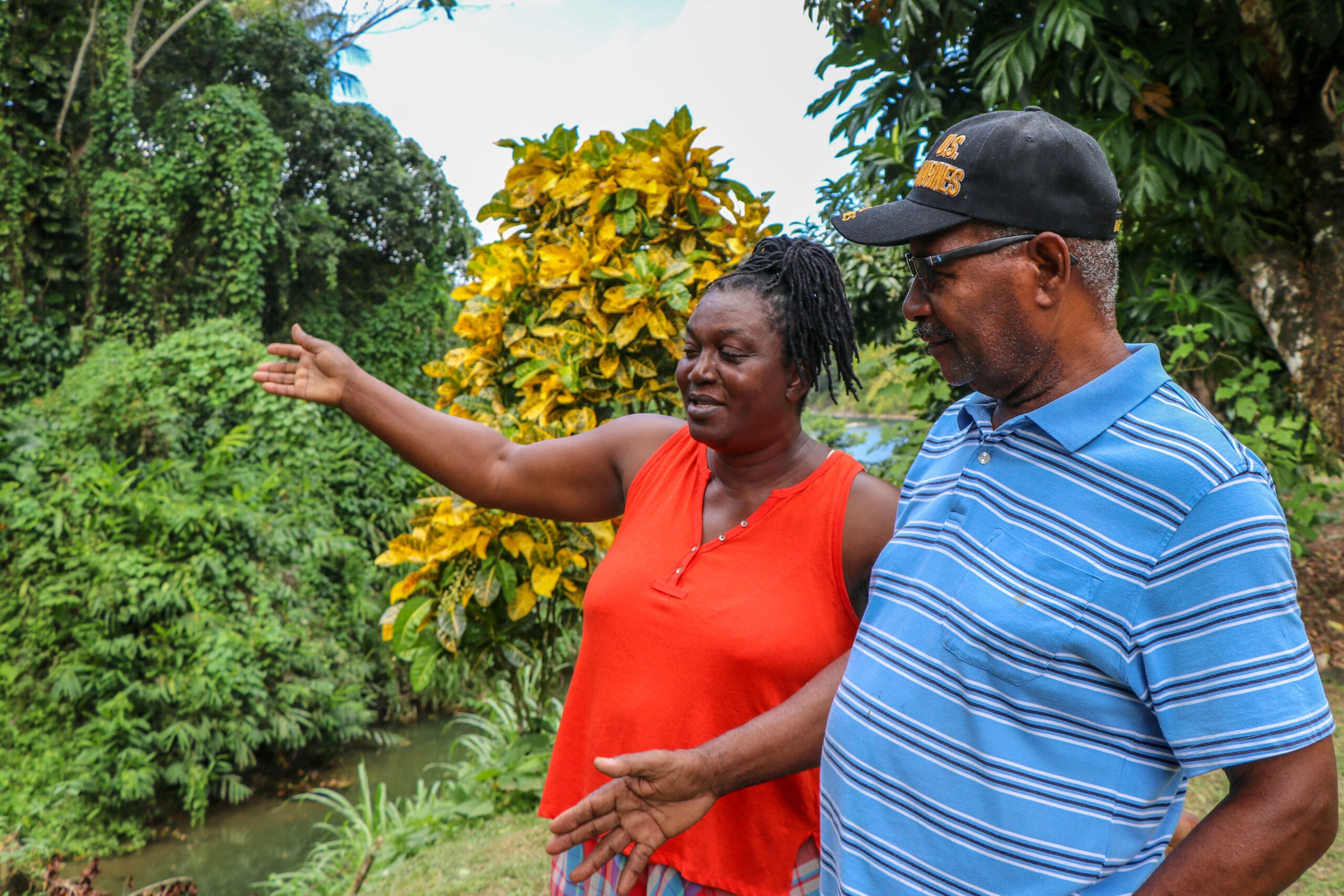
Icema and Vincent Swire’s home in the Fellowship community of Portland, Jamaica, sits where the Sandy River meets the larger Rio Grande River. Their yard is completely bare because the Swires secure any spare tools or items in the trees or chain them to the stilts their house sits on. As Jamaica’s two rainy seasons grow more unpredictable, flood waters along this area of the watershed have risen more than 22 feet, reaching inside the Swire’s home and causing major damage.
“When she and I [first] came out here, you could make one, two steps across the river. The water never used to trouble anybody on this side. In the late ’80s or ’90s, they started to do extensive mining. And because of that, now it starts to eat away the embankment.”— Vincent Swire, a flood victim in Portland Parish
Mining of sand and stone from the Rio Grande River, combined with the growing intensity of tropical storms and hurricanes, is destroying biodiversity and eroding the river bank. During heavy rainfalls, flooding, landslides, and road blockages, which endanger lives and damage local infrastructure, are quite common. “Over the years, it has gotten worse,” Icema said.
The Jamaica Rural Economy and Ecosystems Adapting to Climate Change II (Ja REEACH II) project, funded by the United States Agency for International Development and supported by Jamaican government partners, provided disaster risk reduction assistance to the Fellowship Community Disaster Risk Management Group, a volunteer group of which Icema serves as president.
The Swires and other community members also completed disaster response trainings through the Office of Disaster Preparedness and Emergency Management and the Portland Municipal Corporation.
“We had regular meetings that informed us as to our safety — don’t throw the waste in the drains, what to expect if and when there is flooding, and how can we manage it.” — Icema Swire, a Ja REEACH II project participant trained in disaster preparedness
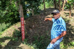
The group received a grant from Ja REEACH II through a partnership with Jamaica’s Water Resources Authority to install equipment as part of a flood early warning system at strategic points in the Rio Grande Valley. As part of this grant, the Swires had two flood gauges installed at their home because of its key location where the two rivers meet and flooding first occurs.
“The orange [gauge] tells us to be on the alert,” Icema said. “When the river reaches nine [feet], that is a sign that it reaches the land on which we’re living. There’s [another gauge] in the front in red. That is the time we must take action.” The Swires are the first to inform neighbors if evacuation is necessary.
“These [flood gauges] are quite a help to the community because [flooding] affects us first, and then we go and tell the news to others.” — Vincent Swire, a Ja REEACH II project participant and flood early warning system user
The Ja REEACH II project also partnered with the Water Resource Authority to install streamflow gauging stations and rain gauges at key points in the upper to mid Rio Grande Valley. The equipment sends information about water and rainfall levels in real time. This data, along with surveys to be carried out by the Water Resources Authority, will inform a flood predication table that guides the dissemination of early warning information to the community. Over 2,000 residents will benefit from the system once completed.
As Jamaica continues to experience temperature increases and intensifying weather, the early warning system is helping build resilience and reduce the threat to local livelihoods and ecosystems. With the knowledge and skills gained from trainings, the Swires and other community members are now equipped to respond effectively during times of disasters.